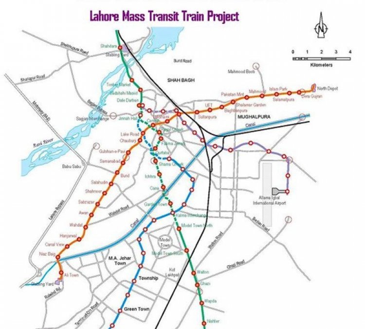
Route Map of Lahore Orange Line Metro Train
Here is the route map of Pakistan's first metro line orange train in Lahore, Punjab Pakistan. Find Out all the stations' names and route maps below.
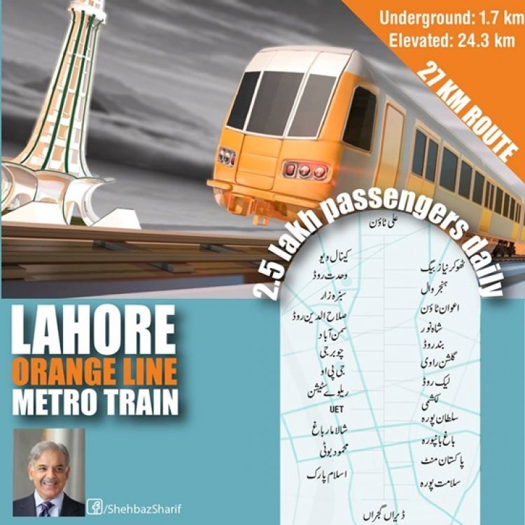
Orange Line is an automated rapid transit line in Lahore, Punjab, Pakistan, and the first driverless metro in Pakistan. It is operated by the Punjab Mass Transit Authority and forms part of the Lahore Metro system. The line is Pakistan's first metro train.
Lahore Orange Line is Pakistan's first Metro Train. The total length of the route is 27.1 km, 25.4 km of it is an elevated section while 1.7 km is an underground section. There will be 26 total stations. When completed it will connect Raiwind, Multan Road, Mcleod Road, UET, Lahore Junction Railway Station, and GT Road. It starts at Ali Town and ends at Daira Gujran.
This train will initially facilitate 2.5 lakh passengers daily.
Lahore Orange Train Map
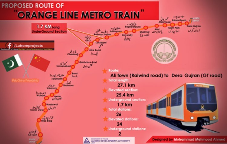
List of Orange Line Metro Train Stations
- Ali Town
- Thokar Niaz Baig
- Canal View
- Hanjarwal
- Wahdat Road
- Awan Town
- Sabzazar
- Shahnoor
- Salahuddin Road
- Bund Road
- Samanabad
- Gulshan-e-Ravi
- Chauburji
- Lake Road
- GPO
- Lakshami
- Railway Station
- Sultanpura
- UET
- Baghbanpura
- Shalimar Garden
- Pakistan Mint
- Mahmood Booti
- Islam Park
- Salamat Pura
- Dera Gujran
 Like
1
Like
1
 Dislike
0
Dislike
0
 Love
0
Love
0
 Funny
0
Funny
0
 Wow
0
Wow
0
 Sad
0
Sad
0
 Angry
0
Angry
0
Enthusiast Young & Passionate Learner born in the 90s in Lahore, Pakistan. Digital Marketer & SEO expert by Profession & Bloggers by Passion.


Comments (0)